Municipal Unit of Gouves
Anopolis

The village Anopolis is located close to Gouves village - beach and relatively close to Heraklion city (17km). If you turn right about half-way through the Kokkini Hani (There is a sign to Anopolis), you'll climb a well-paved winding road which offers some truly outstanding vistas of the town below and its seashore.
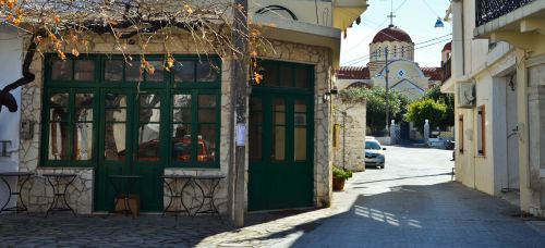
Make sure you bring your camera. Continue on this road for three kilometres and you'll come to the popular traditional village of Anopolis, with many lovely old-style shops offering various local arts and crafts.
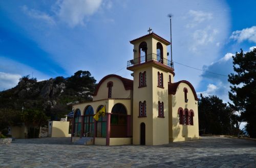
On the edge of the village you will also find the Agios Ioannis Theologos Monastery. It was originally build close to the sea, but most of it was destroyed in a storm. In 1896 it was then moved to Anopolis and restored. The church is filled with frescoes and floor mosaics. Next to the old complex they are now building an even bigger extension of this place.
The Monastery participated at the struggle for the liberation against the
Turkish occupants and there is reference of the existence of a secret school
for Cretan children in the church.
Anopolis is ideal for those wishing to spend quality time in a small, peaceful,
quiet Cretan village with friendly kafeneions yet still be within easy access
of great beaches and beach resort towns. Anopolis is also well positioned as a
base for many excursions throughout the island. The surrounding areas of the
village are ideal for walking, bird-watching, cycling and other country-based
natural activities.

Vathianos Campos
Vathianos Campos (The Plain of Vatheia) is a touristic site on the east of Heraklion. One may find a number of protected sandy bays for shallow water bathing and playing beach sports
-
Vrachokipos

Vrachokipos is a newly founded village next to Vathianos Kampos in the Municipal Unit of Gouves near Kato Vathia, located 15 km east of Heraklion.
Voritsi
.jpg?rnd=1362135400)
Voritsi is a small but lovely village over Gouves, just 25 km away from Heraklio, featured by the natural landscape, the nice people and the picturesque and historical village center.
Near the village of Voritsi is the monastery of Kyra Eleoussa, which belongs to that of Agaranthou, a historical place of great archaeological value.
To judge from the ruins that still stand, this monastery was autonomous and was built according to the fortification needs in Venetian times. It was built over an older monastery, which in turn was almost certainly built on the site of an even older sanctuary. It is the home of Georgios Kostantoulakis, the famous Moses, the legendary practical healer of the early 20th century.
Gouves and Kato Gouves

Gouves proper (Ano Gouves) is a small picturesque village located about 20 km east of Heraklion, in an altitude of 300 m next to the small mountain of Ederi.
Goúves proper is often confused with its busy summer resort, Kato Goúves. Besides this well-developed tourist resort with long sandy beaches, the area has some traditional villages and archaeological sites.
Kato Gouves, just a couple km north of the village, with its long sandy beach, is the summer resort. There is a variety of accommodation, from large hotels to boarding houses and self-catering apartments, and there are many restaurants, bars, nightclubs, and shops.
There are also remains of an ancient Minoan ceramics workshop which is worth seeing, as well as the Christian remains, like the Church of Zoodochos Pigi, patron of the village, the Eileithyia caves.
Within a short distance are picturesque villages and sights, such as the monastery of Saint John "Theologos", the Skotino cave and Eileithyia cave. The most important archeological sites of the area are the Minoan villas of Kokkíni Háni and Amnísos.
The access from Heraklion to Gouves is very easy due to regular and frequent bus itineraries, taxies or rented cars and motorcycles.
Gournes

Gournes is 15 kilometres east of Heraklion. It is part of the largest coastal tourist area in Crete, running from K
okkini Hani to Malia. Gournes is between Kokkini Hani and Gouves, which are both within walking distance along the beach.
The name Gournes comes from "gourna" meaning “basin”, and it is thought that there were many watering-places in the area at one time. The evidence still exists, as a "river" basin still runs through the centre of town. In the summer months, however, it is quite dry, but in the winter rainy season, and during the spring thaw, water rushes through here from the surrounding mountains to the sea below.
Gournes was a small, sleepy village until the late fifties, when the big American Air Force communications (no planes) base opened, occupying a substantial portion of the town property.
While the base population eventually grew to about 3,500 servicemen and their families, the surrounding area kept pace. Many of the first hotels and apartments were built in Gournes to accommodate the families of the servicemen and visitors to the base and its civilian work force.
When the Gournes base closed in 1993, the area was a bit shell-shocked, as about 1,000 locals became unemployed and hundreds of apartments and rooms were vacated.
Since then, Gournes has fought its way back economically, making a good name for itself as a quiet holiday destination, as well as a place where many people from Heraklion maintain their summer homes. The enormous base property with a frontage of 500 meters along the main road is finally showing signs of a new life. After lying dormant for many years, there is now a school, a gymnasium, a municipal town hall services and an exhibition centre, plus and the Crete Aquarium “Thalassokosmos” (Sea World), the largest aquarium in southern Europe.
Gournes has a regular bus service both east and west, for easy access to Heraklion or Hersonissos, as well as many other points along the coast.
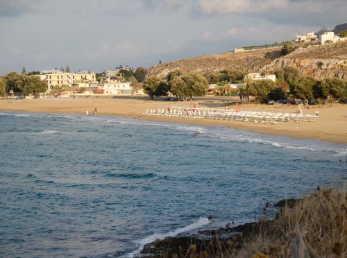
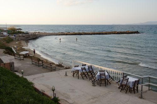
Along the beach-front promenade you'll find several small, but sandy beaches, most with chairs and umbrellas – and some with handy "beach service" for drinks and snacks from the restaurants across the road.
However, the best beach in Gournes is at the far western end of the promenade – the large beach in front of the Hotel Xenia, which is maintained as a working hotel school. This beach is wide, with smooth sand, offers chairs and umbrellas and, in addition, is life-guard protected.
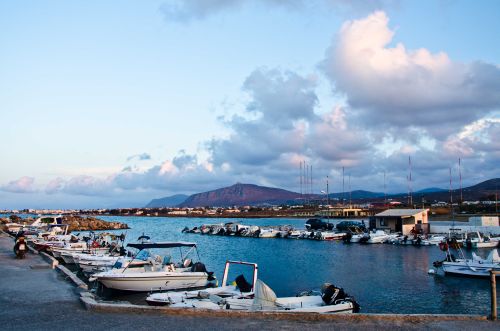
If you continue to the east, past the small fishing harbour of Gouves, you will enter the area of the former American Base.
All along the coast there are several spots where you can go swimming. At the east end of this area, there is the excellent Municipal beach of Gouves, which offers the cheapest sunbeds and umbrellas in the area.
Visit the site of the former American Base. Here you will find beaches without umbrellas for a peaceful swim, The old village of Gournes is a short, uphill walk to the right, from the old road. There are many old village houses, plus some newer homes, side by side, and a nice village church. However, there are no facilities, not even a coffee shop, so bring your own bottle of water if you take the trek.
In the valley of Gournes there is the beautiful old chapel of St. John Bezetis, with many well-preserved frescoes.
The Island of Dia

Dia is an uninhabited island with 5 km maximum length and 3 km maximum width surrounded by small rocky inlets. It is located 6 miles north of Heraklion. It is one of NATURA's protected areas due to its status as a biotope for endemic plants and for plants with low dispersal within the Southern Aegean.
Geography
Dia is 5 km long and 3 km wide and covers an area about 12 sq km, extending from west to east. North of the Dia, there are two islets with gulls, Paximadi and Petalidi. In the southern part of the island there are 4 quiet bays: the gulf of St George, which is the only port of the island, the Gulf of Kapari, the bay of Panagia and the Gulf of Agrielia. On the east, there is the Gulf of Aginara. The island has a maximum height of 220 meters and the landscape is generally characterized by stones and shrubs. There are areas with rocky cliffs that reach 60 meters.
History
Dia played an important role in navigation during antiquity, particularly in Minoan and Medieval times. For the precocious seamen that sailed in the open Cretan Seas, it constituted the best possible natural "signal", indicating the approach of the Cretan coast with its natural harbours, while at the same time it helped in the anchoring of the ships, effectively blocking the strong northern winds. During Minoan times the island was populated and, near the bay of Agios Georgios, a harbour settlement was established.
The Undersea discoveries of Jacques Yves Cousteau in 1974-5, while searching for the lost Atlantis between Crete and Santorini, with a special bathyscape, are of great ecological and archeological interest, as seven wrecks were found on Dia. In 1976, Cousteau discovered some squared and rectangular rocks in the seabed that made up an artificial breakwater, which researchers named Cyclopean Walls. Cousteau suggested that there stood one of the biggest and most important ports in the whole island of Crete. The harbour appeared to have sunk due to the destruction caused in the 1450 BC volcano of Santorini. However, the port was later found to be much older, thus research became more complicated.
Detailed aerial photos also pointed out traces of settlements, confirming the hypothesis that the island was previously inhabited. However, more archeological research in the area is deemed vital for further establishing the evidence found so far.
The island had a small area were vine was grown up by fishermen, till 1937.
Mythology
According to the legend the island was created by Zeus: Zeus, while he was dominating the world from his throne in Olympus, he looked to his birthplace, Crete. He was surprised to see his Cretans hunting with bows and spears, wiping out his beloved wild goats (kri kri). The goats were children of Amaltheia the goat that nurtured Zeus with milk while he was hiding from his father Cronus in Diktaion Antron Cave. He got that angry, that he decided to kill all Cretans. Immediately, he blew a lightning into the sea and a huge monster emerged to destroy the Cretans. However, the other gods tried to make him change his mind, but in vain. Then, Poseidon, the god of Sea, said to Zeus: "My Father and King, how can you devastate Kourites? Is that the way to repay the good that they have made to you?» Kourites were Cretans that were banging loudly on their shields when Zeus was crying, so as not to be heard by his father Cronus, who would eat Zeus. Zeus immediately changed his mind. Then he took two pieces of rusk and threw them towards Crete. So, when the monster tried to eat them, Zeus with a thunderbolt petrified the dragon with the rusks. This is how Dia and the two islets of Paximadi and Petalidi were born.
Also, according to legend, Theseus, after killing the Minotaur, escaped to Dia with Ariadne.
Nature
The island is a very important refuge for native plants and animals with very small dispersion in the southern Aegean and one of the most important areas were falcons nest (Falco eleanorae). On the island, you may see many wild rabbits and hares coming out from the bushes.
Scientists believe that 5000 years ago the island was full of forests, and many springs. However, the forest has disappeared because the wood was used to build ships, while after about 1000 years springs stopped as well.
Also, the island has been approved for sheltering Cretan Wildgoat (Kri Kri). However, before moving kri kri in Dia, scientists must firstly remove any remaining sheep or goat living on the island, so as not to mate with Kri Kri and alter their genetic identity. Despite enormous efforts to find the goats on the island, they have not yet been identified (even by helicopter). Unfortunately, scientists have found their faeces, proving their existence which delays freeing Kri Kri in Dia.
Infrastructure
On the island there are no facilities except a tavern at the port, in the bay of St. George. Here, there is the beautiful church of Analipsis (Ascension of Christ), from where you can observe Crete and Heraklion Gulf. Moreover, from the port begins an stone paved path leading to the north of the island, to the forestry shelter, and another that leads to Analipsis Chapel. Next to the chapel, there is the main shelter, where you can stay overnight (no electricity), after contacting the port Office of Heraklion.
Access
If you don’t have your own boat, there are boats offering daily tours to Dia. They start from the port of Gouves, Hersonissos and Heraklion.
Elia

Elia is a small village on a hill side with panoramic view, in an altitude of 230 meters. The main occupation of the inhabitants is agriculture and especially olives and livestock.
Epano Vathia
Epano Vathia is located about 15 km from the city of Heraklion, in the valley of the Vathianos River. Residents cultivate olives and vines. The old church of Aghios Antonios (St. Anthony) with its remains of frescoes is very interesting and worth a visit.
Kalo Horio
.jpg?rnd=1361440920)
Kalo Horio (the Good Village) is located 7 km south of Gouves and 25 km east of Heraklion. The residents cultivate olives. It is Located on a hill with a panoramic view and close to the village is a gorge.
At a height of 320 m above sea-level, Kalo Chorio is located 25.7 kms. from Heraklion.
The present name does not figure in the old Venetian documents, though there is a reference in the 1367 Duke’s archives to a Kalo Horio.
The villagers pass the history to the young generation as the village was called "Stravorina" in the old days, and indeed there is a reference by Barozzi in 1577 to a village "Stravorina" in the district of "Pediados".
Chourmouzis Vizantios in 1842 mentions Kalo Chorio, the present name was therefore given in the decade 1830-1840.
Southeast of the village, at Korfi Maza (456 m of altitude) a sanctuary was found, dating from the First Middle Minoan to the Geometric Period, as well as religious figurines and various signs. In the temple is believed that a female deity was worshiped, who belonged to the circle of the gods of heaven.
Karteros

Karteros is a village, which is located about 8 km east of the city of Heraklion. There you will find a wide sandy beach that stretches for several kilometers east of the city in the open bay of Iraklion..
The beaches “Florida”, “Karteros”, “EOT” and “Amnissos” are very well organized, very close to Heraklion, with many hotels of all categories and many taverns and restaurants, as well as cafes and bars, covering the needs of all visitors: comfortable accommodation, good food, refreshing drinks and many facilities for swimming and water sports.
The access from Heraklion is very easy with regular and frequent bus, taxi and rented or private cars and motorbikes.
Kato Vathia
Kato Vathia is a village of the Hersonissos Municipality, is situated 15 kilometers from the city of Heraklion in the valley of Vathianos River. Among the sights worth mentioning is the “Porofarango” gorge located in the area.
Kokkini Hani

Kokkini Hani is a coastal village located at the 14th kilometer of the main road to Lasithi, near the Vathianos Campos.
Kokkini Hani became known in the early 20th century, when the first buildings were constructed together with an inn for passing people and animals, kept by a person named Kokkinis.
The area is developed with hotels and seaside taverns, restaurants, cafes and bars as well as clubs with live Cretan music.
There are regular bus services to and from Hersonissos, east and west of Heraklion. There is also a bus to visit the neighboring villages. On the main road taxi ranks are always available.
Koxari
.jpg?rnd=1361440920)
Koxari village is built at an altitude of 180 m, 23 kilometers from Heraklion. It is situated in the green valley of the river Karkania. Near Koxari you can visit the Convent of Kera – Eleousa.
Skotino

Skotino is a village of the Gouves unit. It is a small village of a long tradition. Clay piece shrine and shells were found in the area dated of the Geometric Period
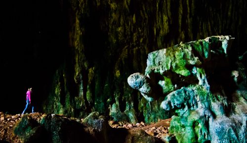
The most remarkable point of this area with history and culture is the Cave of Aghia Paraskevi or Skoteino Cave. This cave, one of the largest and more impressive among the hundred caves in Crete, is located high on a hill northwest of the village of Skotinó, a few kilometers inland south of Goúves. The name Ayía Paraskevi is coming from the church built on top of the cave. The cave is 160m deep and 36m wide. The first archaeologically researches on the site were done by Arthur Evans, the well-known British archaeologist who unearthed and partially restored Knossos in the early 20th century. A more comprehensive exploration was done by French and Greek archaeologists in the 1960s.[ They found a considerable number of bronze and ceramic votive offerings, the oldest of them dating from the earliest Minoan periods, suggesting the cave was an important sacred shrine dedicated to a female fertility deity, presumably Britomartis. The cave was still used in Classical Greek and Roman eras, when the fertility goddess Artemis or her Roman equivalent Diana replaced the Minoan deity.
Charasso

The village Charasso is located on a hill with view on the surrounding area on the southern valley. The distance from Heraklion is 27.3 km. The inhabitants are engaged in agricultural work such as viticulture, olive growing and farming.



.jpg?rnd=1362135400)
.jpg?rnd=1361440920)
.jpg?rnd=1361440920)
.jpg?rnd=1357742372)
.jpg?rnd=1357740135)
.jpg?rnd=1355906960)
.jpg?rnd=1355906692)